
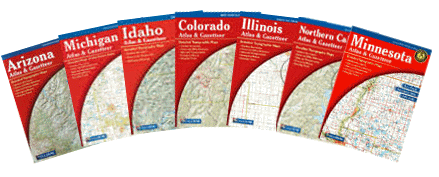
These are just a few of the atlases that we carry, we actually stock 37 states. All are $19.95 except for Texas, which is $24.95. They can all be ordered from our online store. See list of states below.
Each atlas and gazetteer contains topographic maps with unbeatable detail, plus gazetteer information on great places to go and things to do. Each atlas is paperback and 11" x 15-1/2". These are a great source of information especially if you're a traveler that likes to get off the beaten path. Packed with information.
Detail commonly includes:
•Back roads, dirt roads and trails
•Elevation contours
•Boat Ramps
•Public lands for recreation
•Land use / land cover - forests, wetlands, agriculture
•Trailheads
•Campgrounds
•Prime hunting and fishing spots
Typical Gazetteer categories include:
•Hiking
•Biking
•Canoeing/Kayaking/Float Trips
•Museums/Historic Sites
•Campgrounds
•Hunting/Fishing
•Scenic Drives
•Unique Natural Features
•State and National Parks and Forests
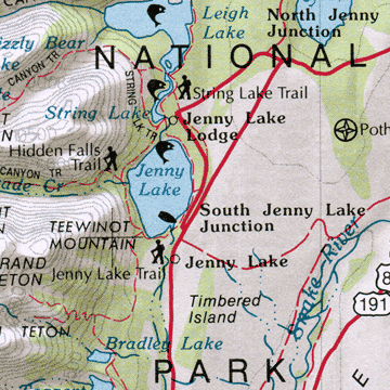 |
sample of map detail |

Click Any State to Add a Delorme Atlas to Your Shopping Cart.
Then be sure to choose that state from the pull-down menu at the checkout.
|
|
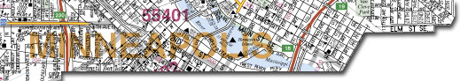
Hudson Map Company
2510 Nicollet Avenue
Minneapolis, MN 55404
tel: 612-872-8818
fax: 612-872-1855
Hours: Monday-Thursday 9-4
Map to our retail store